..........................................................Arizona Jones Outdoors: Hiking, Backpacking, Mountain Biking, and more!

Friday, February 25, 2011

Wupatki National Monument and Sunset Crater

Northeast of Flagstaff Arizona is a place that many people drive right by. They are on their way to The Grand Canyon or Lake Powell. But off the highway there is a loop drive that is packed with interesting things to see. This loop drive has two National Monuments, Sunset Crater and Wupatki National Monument. Sunset Crater is an area of volcanic activity including lava flows and cinder cones, with some as recent as 1000 years ago. If you are heading north on highway 89 the turn off is about 12 miles out of town on the right. This will take you to the visitors center for Sunset Crater. Along this road you will see some interesting lava flows and beautiful Sunset Crater. Sunset Crater is a great example of a cinder cone and is recent enough to still maintain it's shape. There are some nice short trails out into the lava flows that I feel are worth the short walk that have some interesting features and beautiful scenery. If you continue on through Sunset Crater the road will start dropping in elevation giving way to a less forested area and eventually high desert and you will enter Wupatki National Monument. Wuputki is around 2000 feet in elevation lower that the Sunset Crater area. Waputki National Monument is a large number of old pueblo ruins scattered over a large area. The park service says there are as many as 800 different identified ruins scattered over the large area that incorporates the park. Five of the largest ones are easy to visit and right off the road. The largest one is near the visitors center and is called Wupatki (Hopi for "Tall House"). This one is really two main structures and a round community room and a "ball court" all withing a short walk of the visitors center. The ball court is the northern most one of these that has been found and is usually something found in cultures from farther south. There is also a very interesting geological feature right near these ruins. There is this blowhole of vent that leads underground to some unknown passages and it will either blow air out or suck air in depending on temperature or pressure variables. It blows air out with astounding volume and pressure and is really quite fascinating. A second of the larger ruins in the park is called Wukoki Ruin ("Big House"). This one is east off the main road a bit but really is worth the short drive. Wukoki Ruin is built on a stone outcrop and has a tall tower like structure as it's main feature. It can be seen from a long distance away and is really quite beautiful in it's remote setting. As you head north out of the park and continue the loop there are several more sites to visit. My favorite of these is one of the last ones before you leave the park. It is called Lomaki or "Beautiful House". This one has about a half mile walk out to the main structure at the edge of a shallow canyon. There are several other small structures along the way as you walk out to the largest one. Sometimes I just go in the north entrance and stop at this ruin if I have limited time but still want to see some of it. Here is the National Monument web site for more info.
http://www.nps.gov/wupa/index.htm

Thursday, February 17, 2011

I Live In A Cool Place!

I took this picture on my way to work the other day. Thats Court House Butte and Bell Rock as you drive into the Village Of Oak Creek in Sedona, AZ. The next one is some of the locals checking me out. As seen over at Red Rock State Park, in Sedona. Nothing special just another day going to work. Oh yea, and our weather has been in the 60s in mid winter. Life is rough here in central AZ. This one is less than five minutes walk up a trail off a residential area on Soldiers Pass Road
We once had a problem here with graffiti about 800 to a 1000 years ago. This rock is just sitting on the side of Salt Mine Road in residential Camp Verde. This classic Kokopeli Pictograph I found near Sedona out towards Loy Butte and the Honanki Ruins. And then there are some run down abandoned structures here and there. But I'm not complaining. This one is called Palatki. Note the cool medicine wheel pictograph on the cliff above the ruin. Ruins like this are all over the valley here.
This next one is called Montezumas Castle. It pretty well known in fact its one of the National Monuments in my little valley. And once in a while it snows. But really it just makes it more beautiful and it melts by the next day. This shot was taken right from the road, on Schnebly Hill Road, Sedona. Oh and did I tell you that I can trout fish a five minute walk from my house? Yea, I live in a cool place!
Not sold yet?  More on this great place to live. 
http://azjonesoutdoor.blogspot.com/2011/07/verde-valley-i-live-in-cool-place-part.html 

Wednesday, January 26, 2011

Black Canyon Trail, AZ, Hike and Mountain Bike

I live in a beautiful valley in Central Arizona, called the Verde Valley. The Verde Valley has the Sedona area that people come to see from all over the world. But in my area there are many other things that often get over looked. I live in the town of Cottonwood it is south of Sedona and just south of me is a mountain ridge that reaches heights of over 8000 ft. elevation. On the side of this mountain ridge is a trail that climbs up a drainage called Black Canyon. This trail is designated by the Forest service as Black Canyon Trail #114. Most people just hike up and down the trail and many people descend the trail on mountain bikes, but few go off trail and see the hidden secret. Down hidden in the drainage of Black Canyon is a beautiful waterfall. Being in the desert southwest I think it usually only runs in the winter when there is snow on the top of the mountain. This waterfall is a bit difficult to get to so it keeps the masses away. It is pretty much an all day in and out hike, with some steep climbs and some off trail scrambling, but the hike has many rewards, like great views of the Verde Valley and seclusion from all the tourists that swarm the Sedona trails. This area is wild and has deer, elk, mountain lions, bear, and lots of javalinas.
You start the hike at a parking area at the end of Ogden Ranch Road. If there is any snow on the mountains then the waterfall will be flowing. The trailhead elevation is around 4200 feet. From there you take a ATV track west for about 50 yards and then look for a trail leading down into a drainage on your left. Take this trail and it will take you down into the drainage and across and then starts to climb the other side.
This trail will get somewhat steep and rocky at times as it navigates up and over or around a few ridge lines and drainages to take you southwest and into the Black Canyon drainage. Along here you will have some fine views of the Verde Valley.
Once you turn the corner into the Black Canyon drainage the trail will level out as it traverses the south side of a ridge. This is what the drainage looks like that you will be heading into as seen from the trail above.
Along this area of trail you look for a ridge below you that sticks out south into the drainage with a saddle on it with a fire ring made of rocks. At this point you go off trail down to the saddle and then drop down the steep ridge on the west side of the saddle to find your way down into the bottom of the drainage. You will see a small drainage coming in from the north to the major one. You need to cross this above the intersection of the two drainages. This is a photo of the side drainage that comes in from the north
You cannot cross below the intersection because the drainages drop off into a slot that cannot be crossed. Once past this side drainage you then follow the main drainage upstream. It is a bit of a scramble.
If there is water flowing then the waterfall will be flowing too. You have to find your way around several small cascades and some rock pinnacles along the way that I found to be interesting.
Finally the drainage will turn to the right around a corner and the water fall will come into view. It is a pretty tall waterfall but I'm not very good at guessing heights (maybe 70 feet tall?) Many people also mountain bike down this trail. If you are going to do that you would need a car shuttle. Many people start at the top of the mountain and decent Coleman Trail or Gaddes Canyon Trail and then hook up with Black Canyon Trail as it drops off of Allen Springs Road (FR 413) at 6400 ft. elevation. The top part of the Black Canyon trail is in pine forest and runs along a small stream for part of the way. It it is a total of 7 miles from the bottom at Ogden Ranch road up to the top at Allen Springs Road. The bottom part of the trail is high desert type vegetation and there is more than a 2000 foot elevation climb along this trail.
If you are going to try the downhill mountain bike ride I would suggest you take the Gaddes Canyon Trail over the Coleman Trail. The Coleman trail is for hard core technical riders only. All of this is for advanced riders but Coleman is really very rocky, steep, and overgrown. Gaddes Canyon Trail is around a 2.5 mile drop down to Allen Springs Road. If you combine that with Black Canyon you have close to a 10 mile downhill trip. The Gaddes canyon Trail starts at around 7700 ft elevation so you will descend close to 3500 feet on this downhill trip. When you go down Gaddes Canyon and reach the Allen Springs Road (FR 413) you head left or east on Allen Springs road and the Black Canyon Trail will be on the right after more than a mile. Beware that the brush is overgrown in many places on these trails and you will need protection to not end up all cut and scratched up.
To get to the trail heads: For the bottom trailhead of Black Canyon Trail #114, turn off Highway 260 between mileposts 209 – 210 (south) onto the dirt Ogdon Ranch Road (ok for passenger cars). Follow this road 4.3 miles to the parking lot at the end.
To get to the Gaddes Canyon Trail, from highway 89A you take Forest Service road 104 around 2 and 1/4 miles to road 104B. Turn right and the trail will be on your left just a tenth of a mile before you reach the lookout.

Thursday, December 30, 2010

Lake Sabrina to Moonlight Lake Backpack Trip

Here is another great Eastern Sierra backpack trip. This one starts at a large lake called Lake Sabrina at 9132 foot elevation. I like this trip because the starting point is so high that there is not very much climbing to get to the good stuff. This trip heads into a lake basin called The Sabrina Basin in the John Muir Wilderness of the Inyo National Forest in California.
When I did this trip it was years ago. So things may have changed a little. When I did this the trail head parking was near the end of Lake Sabrina Road at an intersection with a westbound road that leads to North Lake. You start the hike by walking south up the paved road for about a half mile where you will find a signed trailhead. The trail traverses along open exposed slopes on the east side of Lake Sabrina. Here is a picture of my three female companions and the view as you start out along this ridge. About 1.3 miles from the road there is a trail junction with an east bound trail that leads to George Lake up on Table Mountain. You continue right or south at this junction. You will soon pass the small outlet creek for George Lake and then the trail starts to climb some switch backs. After the switch backs you arrive at Blue Lake at around 10400 foot elevation. This lake is beautiful and if this were the only lake on the trip it would still be worth the short trip. There are great views south across the lake of some dramatic peaks along the Sierra Crest, with a prominent pointed bare spire in the foreground that is close to 12,500 feet tall and Thompson Ridge with Mount Thompson at over 13,400 foot height behind in the back ground. This lake is only a little over 2.5 miles from the road so many day hikers can make this their destination. The trail then crosses the outlet creek of Blue Lake and then heads along the west shore of the lake. After a short way you come to a trail junction. If you head straight it will take you to Donkey Lake and the Baboon Lakes, a worth while side trip if you have the time. I did this on the way back. This is what it looks like up there at one of the lakes. And there is a lot of great stuff to explore using these lakes as a base camp you could go up to Sunset Lake and get a view of the Thompsom Glacier. But our trip takes the right fork and heads west at this junction. After about a mile and a quarter from this trail junction you will get to the largest of the Emerald Lakes about four miles from the road. You pass this lake and continue southwest up over a small rise to Dingleberry Lake at about 10490 foot elevation. You pass this lake along it's east shore and continue up the drainage. Less than a half mile past Dingleberry Lake and about five miles from the road there is a trail junction. If you head south or take the right fork it will take you to beautiful and dramatic Midnight Lake. Midnight Lake is at close to 11,000 foot elevation and is in a bowl surrounded by steep rocky cliffs and ridges and dramatic peaks. I camped here and loved the beautiful play of light off the peaks. I believe that the tall peak reflected in this photo is Mount Darwin at 13,831 feet tall. If you take the left fork of the trail junction below Midnight Lake it takes you to Topsy Turvy Lake where there are some great campsites with fantastic views. If you continue on past Topsey Turvy Lake you will soon reach Hungry Packer Lake at 11,070 foot elevation about 6.3 miles from the road. This lake has a dramatic spire called Picture Peak rising up just south of it making for a beautiful scene. From here it is a short walk west over to Moonlight Lake were the views across the lake to the Jagged Sierra Crest are fantastic. These photos were taken at the outlet of Moonlight Lake and fit together as a panorama. The prominent Peak in the fore ground is Picture Peak with Mount Hackel in the right background and Mount Powell and the Clyde Spires to the Left. Here is a pieced together panorama of the view from this same location as is the one at the start of the post. From here you can continue up the valley to the source of the Middle Fork of Bishop Creek to Echo Lake. If you are really a veteran and experienced back country traveler you could cross the Sierra Crest via this trail less route over Echo Pass and end up in Kings Canyon National Park in the Evolution region. Me I just enjoyed the short walks between the fantastic lakes in this basin and then headed back the way I came. By the way all these lakes have abundant trout if that's your thing. Like all Eastern Sierra trips in wilderness areas permits are required, so plan in advance.
If you want a good map with picture interface this site is great and his photos are real fine http://doors.stanford.edu/~sr/sabrina-2006/map.html

Wednesday, November 24, 2010

Mountain Biking in Sedona, AZ

I live 20 minutes from Sedona and I have mountain biked there many, many times. I have been riding there frequently since the late 90s. I went there just last weekend and the weather was a perfect 72 degrees. The trails in Sedona are very nice and the scenery is amazing, I'm talking truly amazing. So I decided to share some information about this great place to mountain bike. Sedona has trails all around it, in fact you can almost ride around the whole city on trails except for a few places that are wilderness and they don't allow bikes. The trails are well maintained and well marked in most cases. The trails have a wide variety of difficulty level. In some places it will be smooth and easy going but in many cases there are some difficult and technical sections. Most of the technical sections are short and if it is beyond your skill you can just walk that part and be back on your bike riding primo trails again in no time. The Sedona trail system has in my view four main parts. They are the south, north, central, and the west areas. There are some areas not included in these four main parts, but for ease of discussion I will exclude them. My favorite is the south area followed by the north area, but it is all good. In this post I will talk about the north and south parts and deal with the others at another time. I have pieced together a few maps to help out. They were partial areas and had some inaccurate info so I tried my best to improve them.
The south part is from Munds Mountain Wilderness on the east side to Oak Creek and from Morgan road and Broken Arrow trail head in the north south to the Village of Oak Creek. This area of trails divided in two by highway 179. There are two places where you can go under the highway bridges or in a tunnel that connect the areas. Running north and south through this area parallel to the highway is the Redrock Pathway, and many of the trails branch off from it. The Redrock Pathway is a wide foot and bike path that starts at the Courthouse Butte parking area and goes north terminating at the Little Horse Trail Head parking area. The Redrock Pathway is reasonably smooth (by Sedona standards) and is wide so people traveling in both directions can pass with ease. It is a good place for beginners to try mountain biking for a first time. No technical skill needed at all. The main trails that branch off the Redrock Pathway are the Llama Trail and the Little Horse Trail on the East side and the Templeton Trail and the HT trail on the west side.
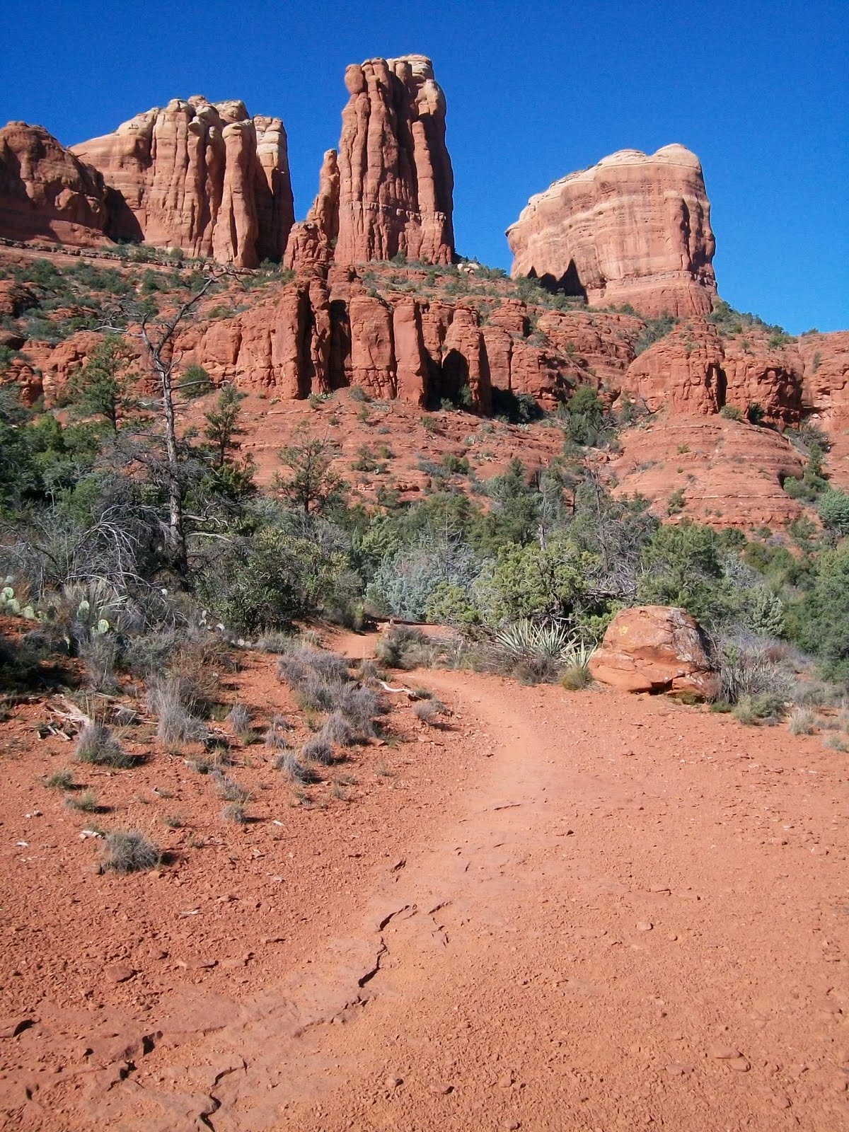
The Templeton Trail branches off the pathway just north of what is called "Baby Bell" (a small rock butte just north of the much larger Bell Rock) and heads west and then goes under the highway and then takes you to Cathedral Rock. The trail skirts along the north flank of this ridge that contains Cathedral Rock and then leads you to Oak Creek then goes south along the creek and eventually to world famous Red Rock Crossing. I love this trail for it's scenery and I love a part that travels for a time on a nice rock ledge contouring to the terrain around the base of Cathedral Rock. It is very cool. Along the way you pass the Cathedral Rock Trail coming up from the Cathedral Rock trail head and heading up to the saddle of Cathedral Rock. Once at Red Rock Crossing you can cross the creek and head into the central part of the trail system that takes you to what is called West Sedona or you can complete a loop around Cathedral Rock by taking Verde Valley School Road back into the Village Of Oak Creek and Highway 179. Or you can go south into Redrock State Park and to more trails.
The HT trail branches west off the Redrock Pathway near the north end of the pathway. It too goes under the highway and then connects to the Templeton Trail and helps make loop rides happen that can include parts of Templeton Trail. There is also a trail that heads south from the intersection of HT trail and Templeton Trail that is somewhat new that goes all the way to The Village Of Oak Creek on the west side of the highway. This new trail is very cool and helps make for some new longer loop ride opportunities. This photo is taken from that trail west of the highway and Bell Rock, looking out to the northeast toward Elephant Rock and the Twin Buttes Branching off to the east side of the Redrock pathway is the Llama trail. This trail branches off to the east just north of Courthouse Butte. There is a major intersection on the pathway where a trail that circles Courthouse Butte heads east. You take this and after a short way the Llama Trail splits off to the left heading northeast. You cannot take a bike on the Courthouse Trail around the Butte because it is in a wilderness area so you must turn off at the Llama Trail before the Wilderness boundary. Llama Trail was started by a guy that did Llama tours years ago and then was found by mountain bikers. The Forest Service did not really maintain it or recognise it as an official trail for quite a long time. When I first started riding it 13 years ago it was little used and narrow. Now it is quite well traveled and wider like most Sedona trails. This photo is a typical view along the Llama trail looking east to what I guess would be Lee Mountain in the Munds Mountain Wilderness. The Llama trail skirts along the west border of the Munds Mountain Wilderness heading north and eventually intersects the Little Horse Trail .
The Little Horse trail branches east off of the Redrock Pathway near it's north end and heads up to a pass between some large mountains called Chicken Point. It travels just south of two large and impressive spires of rock called the Twin Buttes (also called two sisters). The trail leads you up to a pass between the mountains called Chicken Point. Chicken Point is a large area of flat slickrock at the north east base of the Twin Buttes with a steep drop off on the south side. This has great views off to the south and west and the jeep tours take people out here. This is what it looks like just east of Chicken point looking west at the east side of the Twin Buttes. This old dude on an old classic Ibis bike is me AZ Jones on the slick rock at Chicken Point. At this point there is a trail at the west end of the slick rock area that heads north along the base of the mountain called Elephant Rock. You just follow the rock stack markers. Don't take the jeep roads. This trail is called Broken Arrow Trail. Broken Arrow Trail has great views across an unpopulated valley to Munds Mountain and the Devils Dining Room. The Broken Arrow Trail takes you north to the Broken Arrow trail head at the end of Morgan Road. There is a short side trail that leads down into the valley to a large exposed rock area called Submarine Rock that is fun to freelance all over.
The north area of trails in Sedona is divided into two parts by Oak Creek. East of the creek are the Huckaby Trail that That goes from Schnebly Hill road parking area down to the creek under Migley Bridge and the majority of it is downhill. But once at the creek there is a steep climb up out of the canyon to get the the road and parking area at Migley Bridge. East of the Schnebly Hill parking area is the Munds Wagon Trail. This trail runs parallel to Schnebley Hill Road and ends up at an area called The Carousel. This is uphill most of the way with a few crossings of a wash and a few crossings of the road. You could have someone drop you off at the top and ride downhill and continue on Huckaby all the way to the Oak Creek. It would be a fun downhill run. Part way up the Munds Wagon Trail is a side trail to the north that leads out to some large flat areas of rock called the Cow Pies. This is a fun place to just goof around. like a giant skate board park for bikes but with world class views. At the north most of the Cow Pies there is a trail that heads west along a ledge in the rocks out to a saddle and then drops over the saddle and down to Oak Creek and comes out at Grasshopper Point in the canyon. This photo is taken from the Cow Pies looking at the saddle. This trail to the saddle and down the other side is called Hangover Trail. It can be difficult to follow and has some very difficult and technical sections that should be tried by advanced riders only. There is some serious exposure in some spots on this trail.
The other half of the North area of Sedona trails is west of Oak Creek. This part has a trail called the Thompson Trail that starts at Migley Bridge heads north and then southwest along the base of Steamboat Rock. Steamboat rock is a prominant rock formation at the base of the large mass of Wilson Mountain. This photo is of Wilson mountain as seen looking northeast from the Jordan Trail. The Thompson Trail follows an old wagon route that Jim Thompson an early homesteader used to take supplies up into Oak Creek Canyon. The Thompson trail goes from Migley Bridge at one end to the Brins Mesa Trail Head Just Northwest of the older or uptown part of Sedona. You cannot take the Brins Mesa Trail (that heads north) because it heads into wilderness areas where bikes are not allowed. Instead you continue from there west on The Jordan Trail into an area that the locals call the Secret Trails. The Jordan Trail will take you over the Soldiers Pass Trail Head and Coffee Pot Rock. This is a typical scene olong the Jordan Trail looking west toward Coffee Pot Rock. The Secret Trails area has several side trails and many wind up in the bottom of a wash and into a maze of bootleg trails that can be confusing. This is a photo looking north from the Secret Trails area. Once over at the Soldiers Pass Trail head there is another trail that heads west called the Tea Cup Trail that takes you out west at the base of Coffee Pot Rock and up to Sugarloaf and the Little Elf Trail Head. From here you can continue west out past Chimney Rock and Lizard Head Rock and out to the western area of trails that I will cover in another post.