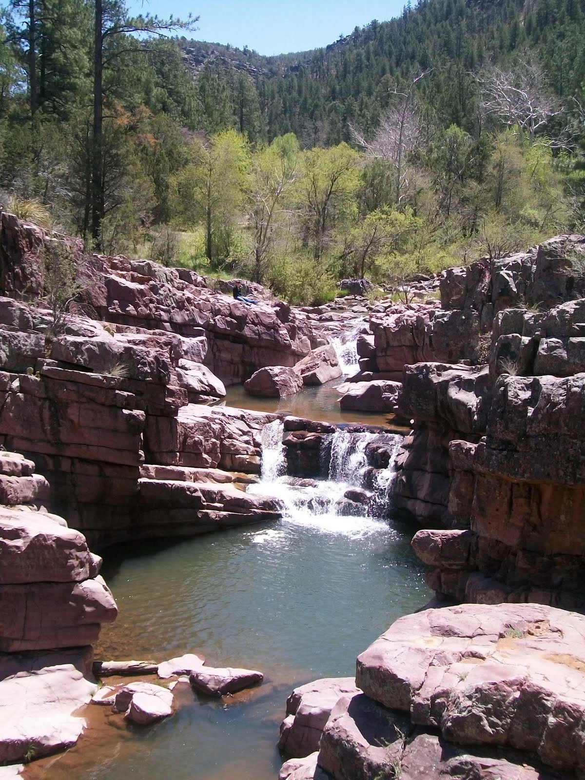
The weather is warming up here in Central Arizona. Warm weather in Central Arizona means time to go to to one of the many creeks for a swim to cool off. The most well known of these swimming destinations is Slide Rock State Park in Oak Creek Canyon.
Slide Rock State Park is located along beautiful Oak Creek in beautiful Oak Creek Canyon. Slide rock for me brings back great memories because my parents took me to this place several times when I was a kid, and now I take my child there. The most notable feature of Slide Rock is of course the natural water slides that are created by the creek as it flows over carved out and smooth flat sandstone.
There are a series of slides and pools with some deeper places with channels cut through the rock where people can jump off the small rock cliffs along the creek.
The rock when wet is very slippery and you will often see people take a fall as their feet go out from under them. Sometimes resulting in an unexpected trip down a water slide, in some cases with camera equipment along for the ride.
Downstream from the water slides and below the highway bridge are deep pools with large cliffs that the brave ones do some cliff diving into the creek below. Upstream from the water slides are some beautiful sections of the creek that that pass between some moderate cliffs, that can be more secluded and a nice break from the crowds found at the water slides below.
This place is like a natural water park all in an amazing setting below towering redrock canyon walls. Summer at slide rock can be very crowded an often the parking area gets full so getting there early is advised to be sure to get in.
The park opens at 8:00 AM and closes at 7:00 PM during the summer. The water can be pretty cold but in hot weather reaching 100 degrees it can be just what is needed.
Another feature of the park is the old homestead structures. The area that the park is in was homesteaded by Frank Pendley in 1907. His family owned the land until 1985 when it was sold to the Arizona State Parks. You can still see apple trees that were part of the orchard that Pendley planted in 1912, and small cottages that were built in the 30s and 40s. Along with this are some interesting equipment used to make the homestead work including a water wheel that was used to generate electricity before power lines were available in the canyon.
This is a great destination that has something for everyone to enjoy and is one of the most visited locations in Central Arizona. For me it brings back childhood memories because it has not changed much since I was a little kid when my parents would bring me here on summer adventures. Sure there is a parking lot now, and they make you pay, but the creek and the water slides are pretty much the same.
Here is more on this great place. http://azjonesoutdoor.blogspot.com/2011/06/slide-rock-state-park-arizona-part-two.html
..........................................................Arizona Jones Outdoors: Hiking, Backpacking, Mountain Biking, and more!
Wednesday, May 25, 2011
Saturday, May 21, 2011
Fare you well, fare you well, I love you more than words can tell
My father was born in New York. He joined the Navy in World War Two as an electricians mate. He got a degree in electrical engineering and after the war moved to Arizona. He married my mother shortly after that. Dad's first job after the war was surveying for power lines for Arizona Public Service. He surveyed for the first power into Phantom Ranch in the Grand Canyon, and the first power in to Crown King as well as power coming off the rim into Sedona, and power lines across Mingus Mountain running from Prescott to Jerome. He saw every corner of this state, before much development happened. He was on the first planing and zoning commission for Scottsdale Arizona. During this time in Scottsdale my mom and him were blessed with three children. My father latter got a job with General Electric where he got in on the ground floor of the computer industry and after a while was involved with projects including computer systems for the French government, Saudi Arabian government, as well as the IRS. Latter on we moved to New York and then to California where he worked for Xerox. This was how a kid who was born in Arizona went to high school in California. Finally he cut ties with big cooperate work and bought a Delicatessen on the beach in Ventura California, and followed his passion for cooking and fine food and developed his business into two stores and a large catering business. Finally Dad sold the business and his house and bought a motor home and my mom and him traveled for several years. It was during this time he got involved in the tour guide business, working for Caravans De Mexico out of El Paso Texas, giving RV tours down to Mexico. He soon was also working for other tour companies doing western states National Park tours. during this time my mom was perfecting her skills doing fine art oil paintings. Eventually they decided to stop traveling and let my mother pursue her dream of being and artist. They picked Cottonwood Arizona as the place to settle. My mom and dad started an art supply store and studio and my mom sold paintings, did framing and matting, and taught painting, while my father ran the art supply store. During this time my father got a job with an over seas tour company and got paid to give tours to Australia, New Zealand, Tahiti and Fiji, he also gave 36 day tours to South America. About 16 years ago my father's earlier smoking habit caught up with him and he was diagnosed with emphysema. It was around this time I moved here to Cottonwood with my wife to help out my parents. From there on he had a slow decline until finally he was completely house bound and wheel chair bound about seven years ago. 20 months ago he was no longer even able to get out of bed, where he has been since. My mom has been lovenly caring for him this whole time. Finally at around 10:00 on May 21st 2011 dad passed away in his sleep at home. He was a great husband to my mom, and was a great father to me and my sisters giving us a jump start in life so we had great opportunities. He taught me a lot about many things, including cooking, working with my hands, but most of all how to love living. He love good food, drink, and music, but most of all he loved my mother.
Fare you well my honey
Fare you well my only true one
All the birds that were singing
Have flown except you alone
Goin to leave this Broke-down Palace
On my hands and my knees I will roll roll roll
Make myself a bed by the waterside
In my time - in my time - I will roll roll roll
In a bed, in a bed
by the waterside I will lay my head
Listen to the river sing sweet songs
to rock my soul
River gonna take me
Sing me sweet and sleepy
all the way back back home
It's a far gone lullaby
sung many years ago
Mama, Mama, many worlds I've come
since I first left home
Goin home, goin home
by the waterside I will rest my bones
Listen to the river sing sweet songs
to rock my soul
Goin to plant a weeping willow
On the banks green edge it will grow grow grow
Sing a lullaby beside the water
Lovers come and go - the river roll roll roll
Fare you well, fare you well
I love you more than words can tell
Listen to the river sing sweet songs
to rock my soul
Brokedown Palace
Thanks to all those who have prayed and shown compasion. It means so much!
Fare you well my honey
Fare you well my only true one
All the birds that were singing
Have flown except you alone
Goin to leave this Broke-down Palace
On my hands and my knees I will roll roll roll
Make myself a bed by the waterside
In my time - in my time - I will roll roll roll
In a bed, in a bed
by the waterside I will lay my head
Listen to the river sing sweet songs
to rock my soul
River gonna take me
Sing me sweet and sleepy
all the way back back home
It's a far gone lullaby
sung many years ago
Mama, Mama, many worlds I've come
since I first left home
Goin home, goin home
by the waterside I will rest my bones
Listen to the river sing sweet songs
to rock my soul
Goin to plant a weeping willow
On the banks green edge it will grow grow grow
Sing a lullaby beside the water
Lovers come and go - the river roll roll roll
Fare you well, fare you well
I love you more than words can tell
Listen to the river sing sweet songs
to rock my soul
Brokedown Palace
Thanks to all those who have prayed and shown compasion. It means so much!
Tuesday, May 3, 2011
Exploring the Mogollon Rim Country of Arizona
I just got back from three days in an area of Arizona called the Rim Country. This area is called that due to the predominant geological feature called the Mogollon Rim. This "rim"is a long cliff like uplift running east to west for close to 200 miles. It is essentially the southwest edge of the Colorado Plateau. The south edge of the rim rises to heights over 7000 feet in elevation with some points reaching as much as 8000. Below the rim are areas of around 5000 to 6000 foot elevation sloping away south gradually. This area, both above and below the rim, is part of a huge forest of pine trees that comprises the largest stand of Ponderosa pines in the world.
This stand of pine forest covers tens of thousands of acres from west of Flagstaff in the west all the way into New Mexico in the east.
Most people when thinking of Arizona think of desert, but much of Arizona is covered with this vast pine forest. This high area, due to it's altitude has significant snow fall in winter and because of this is a source of many streams that run south and north away from the rim. This along with the cooler temperatures due to altitude make this a favorite area to escape the heat of the deserts in the summer months.
When I went there I stayed in a small town below the rim called Christopher Creek. Christopher Creek is at about 6000 foot elevation surrounded by dense forest with a year round stream running through the small town.
There are many hiking and mountain biking opportunities there in every direction with campgrounds as well as undeveloped camping opportunities. The stream called Christopher Creek starts at the base of the rim at a place called See Canyon where there is a nice trail that runs along the creek through the forest. Downstream from the small town the creek enters an entrenched canyon called The Box. .
The Box is hard to navigate and has small falls and pour offs with deep pools and requires getting wet and some climbing skills to navigate up and down the canyon.
The canyon rock is comprised of block shaped basalt rock.
Up on the rim north and east of Christopher Creek are five small lakes nestled among the pine forests, called the Rim Lakes.
The rim lakes are in depressions on the rim and collect snow melt during the winter. These lakes are stocked with trout and are packed with fishermen during the summer months.
Along the rim is a dirt and gravel road called the Rim Road or The General Cook Trail that follows the edge of the rim for close to 40 miles. Along this road are great views of the vast forested areas below the rim.
The rim area has many wonderful places to camp, both developed campsites and just dispersion camping with no facilities. The forest on the rim being higher is more lush and diversified having some spruce and aspen trees as well as the ponderosa pine. Elk, deer, and wild turkey are often seen in these forests. Below the rim as I said are a series of streams and creeks that flow south, Some big and some small.
We explored Haigler Creek, Christopher Creek, Tonto Creek and the East Fork of The Verde River. The East Fork of the Verde appeared to have the largest amount of water flow, and some great places but also appeared to have some of the most development. Yet even with this there were plenty of opportunities to get away from the crowds, this early in the year.
There are many hiking and mountain biking trails in this vast area with the most notable trail being the Highline Trail.
The Highline trail runs for more than 50 miles along the base of the rim through dense forest and rolls up and down as it descends and climbs out of the many stream drainages it crosses. In many places it can be mountain biked as well as hiked. I have ridden the east end and some of the connecting trails and found it to be some real nice riding.
This time, when we went, instead of camping we stayed at the Christopher Creek Lodge. This lodge, founded in 1950 is a group of small rustic cabins along the creek. http://christophercreeklodge.com/
I found it to be a great base camp for exploring and loved the creek side location and the feel of the place. No frills but all you need with wood stoves, and a kitchen and a great location with the sounds of the creek to put you to sleep at night.
This stand of pine forest covers tens of thousands of acres from west of Flagstaff in the west all the way into New Mexico in the east.
Most people when thinking of Arizona think of desert, but much of Arizona is covered with this vast pine forest. This high area, due to it's altitude has significant snow fall in winter and because of this is a source of many streams that run south and north away from the rim. This along with the cooler temperatures due to altitude make this a favorite area to escape the heat of the deserts in the summer months.
When I went there I stayed in a small town below the rim called Christopher Creek. Christopher Creek is at about 6000 foot elevation surrounded by dense forest with a year round stream running through the small town.
There are many hiking and mountain biking opportunities there in every direction with campgrounds as well as undeveloped camping opportunities. The stream called Christopher Creek starts at the base of the rim at a place called See Canyon where there is a nice trail that runs along the creek through the forest. Downstream from the small town the creek enters an entrenched canyon called The Box. .
The Box is hard to navigate and has small falls and pour offs with deep pools and requires getting wet and some climbing skills to navigate up and down the canyon.
The canyon rock is comprised of block shaped basalt rock.
Up on the rim north and east of Christopher Creek are five small lakes nestled among the pine forests, called the Rim Lakes.
The rim lakes are in depressions on the rim and collect snow melt during the winter. These lakes are stocked with trout and are packed with fishermen during the summer months.
Along the rim is a dirt and gravel road called the Rim Road or The General Cook Trail that follows the edge of the rim for close to 40 miles. Along this road are great views of the vast forested areas below the rim.
The rim area has many wonderful places to camp, both developed campsites and just dispersion camping with no facilities. The forest on the rim being higher is more lush and diversified having some spruce and aspen trees as well as the ponderosa pine. Elk, deer, and wild turkey are often seen in these forests. Below the rim as I said are a series of streams and creeks that flow south, Some big and some small.
We explored Haigler Creek, Christopher Creek, Tonto Creek and the East Fork of The Verde River. The East Fork of the Verde appeared to have the largest amount of water flow, and some great places but also appeared to have some of the most development. Yet even with this there were plenty of opportunities to get away from the crowds, this early in the year.
There are many hiking and mountain biking trails in this vast area with the most notable trail being the Highline Trail.
The Highline trail runs for more than 50 miles along the base of the rim through dense forest and rolls up and down as it descends and climbs out of the many stream drainages it crosses. In many places it can be mountain biked as well as hiked. I have ridden the east end and some of the connecting trails and found it to be some real nice riding.
This time, when we went, instead of camping we stayed at the Christopher Creek Lodge. This lodge, founded in 1950 is a group of small rustic cabins along the creek. http://christophercreeklodge.com/
I found it to be a great base camp for exploring and loved the creek side location and the feel of the place. No frills but all you need with wood stoves, and a kitchen and a great location with the sounds of the creek to put you to sleep at night.
Sunday, April 10, 2011
Kartchner Caverns State Park, AZ
Last weekend I traveled down to southern Arizona with my family to visit Kartchner Caverns State Park. My child was given a school assignment to do a report on the State Park so we thought first hand experience would be better than anything else for her. We found out they have a campground and made reservations. We also found that all tours of the caverns are guided and should be reserved in advance.
And of course we were treated with a great Arizona sunset over the Whetstone Mountains to end our last night there. A fine grand finale to a nice little family adventure.
When we arrived at the campgrounds we found a dry desert landscape. Even though the elevation is close to 4600 feet it was not much different than what you would see at my house at 3000. I guess the winter storms tend to track north of there. Up in Central and Northern AZ at 4600 feet you would see some juniper and occasional pinion pine but not down south. It was all mesquite trees, prickley pear and barrel cactus, some yuccas, with some ocotillo thrown in for variety.
At the camp ground the scenery is dominated by views of the Whetstone Mountains a ridge of mountains that rises up to close to 8000 feet in elevation. There are two hiking trails that leave the campgrounds and go up into the hills and mountains. One is a loop trail that climbs the foot hills and returns, the other is an out and back that goes well up into the forest service land of the mountain range.
The main draw of Kartchner Caverns State Park is of course the caverns themselves. The caverns were discovered by two college students back in 1974 and they kept it a secret for 14 years until they could get it protected by the owners of the land and the State Park Service. The caverns are named after the owners of the land that the caves were found on.
The State Park Service has gone to great lengths to keep the cave as well preserved as possible. This includes keeping the moist environment stable and free of outside air and dirt. They control the amount of light and no cameras are allowed in the caverns. So all the photos of the interior of the cave I had to find online. You go through a series of sealed doors as you descend down tunnels to the cave entrance. Once inside you find an amazing display of formations that are still being formed.
The paths are controlled to keep dirt from contaminating the cave and more than 85 percent of the cave has never been walked on. When you compare the glistening wet formations of this cave to ones you see at other places that are all dried out, there is no comparison. Not only is it well preserved but it is world class. containing some rare and in some cases best formations (speleothems) of calcite in the world. They say it has the 2nd longest recorded example of a soda straw formation. Soda straws are very thin formations that hang down from the ceiling. Along with that it has one of the largest columns (Kubla Kahn) in North America. And amazing flowstones, shields (including parachute, welt, and turnip types), and draperies to go along with all the stalactites, and stalagmites (including totems and fried eggs), cave popcorn, helectites, and boxwork.
One of my favorite formations was called cave bacon. I guess it is formed when water comes through a crack in the cave ceiling and with time makes a thin sheet of minerals the length of the crack. It really does look like bacon.
There are two different tours of the caverns that you can take that take you to two different parts of the caves. Both of them are outstanding and I would advise you to do take both tours if you can.
The visitors center is called the Discovery Center because along with being the place you pick up your reserved tickets or purchase the "walk-up" tickets, and catch the tram up to the cave entrance, there are many informative displays and exhibits about the history, formation, and discovery of the caverns. The campgrounds have nice showers and bathrooms, and each site has water and electric. Most of the campers were in large recreational vehicles, basically houses on wheels. I'm more of the tent kind of guy myself.
Here is Holly our fierce guard dog on duty keeping watch over the camp making sure everything is in order.
If you are planing a trip there I recommend reserving tour tickets in advance, because only five per tour are saved for walk-up purchase. For more information about prices and reservations here is the State Park website. http://azstateparks.com/Parks/KACA/index.html
Thursday, March 17, 2011
Mountain biking at Dead Horse State Park, AZ
Most of you know I live in a town called Cottonwood, AZ in the Verde Valley just south of Sedona. Cottonwood is overlooked by most visitors to the Verde Valley who come to see Sedona and the old mining town Jerome. But Cottonwood has some cool stuff too. In Cottonwood is a place called Dead Horse State Park that has a trail system to hike and mountain bike on. The park is located along the Verde River the only designated wild and scenic river in Arizona. Normally I park outside of the park to avoid the entrance fees and then just ride in on trails by turning right down a steep slope just after I cross the bridge or I go past the entrance station about 50 yards and enter on a trail to the right.
Once in the park there are tons of trails that wind all around connecting the different camp grounds and fishing lagoons. Some of the trails parallel the river among the large cottonwood and elm trees.
And some cruise and wind through the beautiful mesquite groves that are closer to the river and many travel through the desert areas farther away from the river.
Most of these trails are very smooth and easy with a few short steep climbs and in some cases a few small foot bridges to cross small washes
Now all these trails are nice but the real attraction for me is the trail system that leaves the park and climbs the mesas north and east of the park. There are two main trails that head up the mesas. One is called Lime Kiln Trail and it is heads east out of the park and the other one is called Raptor Hill at it generally heads north out of the park.
Both of these trails climb in stair step like increments of short steep climbs with flat smooth areas between climbs. The state park near the river is around 3280 feet in elevation and on Raptor Hill trail you will be at around 3900 when you get to the trail junction with the Thumper Trail after traveling 2.85 miles.
Thumper Trail runs southeast from Raptor Hill Trail and connects with the Lime Kiln trail completing a loop. If you are traveling east on Lime Kiln Trail you will reach the Intersection with Thumper Trail after about 2.1 miles. It is 2.25 miles to get from one end of Thumper to the other making the entire loop about 7.2 miles of trail. Add in the time on the trails in the park and you will be doing at least 8 miles to do the loop. Thumper Trail gains and looses elevation several times as it goes in and out of a series of washes. At the Raptor Hill and Thumper intersection there is also a trail that heads off to your left or north this can take you to several longer options. The most noted is the Upper Raptor Hill Trail that was once called Indian Chimney but the name was changed by the State Park people. Upper Raptor can be easy to miss, it is on the right a few hundred yards north down a double track from the Raptor/Thumper junction. Upper Raptor starts by going up a small wash and then climbs up out of the wash to the right.
Upper Raptor continues your climb to the top of the mesas and connects to a series of Forest Service roads. The top of the mesas reach an altitude of at least 4300 feet and maybe even more. The top of the Mesa has juniper and pinion pine. Along the steep northeast edge of the mesa are nice views of the Red Rock country. This trail system is great in winter, spring, and fall, but can get hot in the Summer.
I often take a break here to enjoy the view and then return the way I came with a long downhill to end the day. By adding some of the forest service roads you can make loops as long as 20 or more miles. And for the very hardy you can take Lime Kiln Trail all the way to Sedona a long trek of at least 15 miles one way.
There are two bike shops in Cottonwood If you need repairs or forgot something when you visit.
They are both located on main street not far from the park. One is called Sultana Cycles and is located at 470 S. Main, Suite B. Cottonwood, AZ. (928) 649-3822, Sultanacycles@gmal.com The other one is called Zoomers Bike and Gear and it is located at 743 N. Main Street, Cottonwood, AZ. (928) 202-4941, http://www.zoomersbike.com/ To get to Dead Horse State Park, from I-17 take (exit 287) Hwy 260 to Cottonwood. Hwy. 260 intersects with 89A/Main Street. Turn left on Main Street and proceed to North 10th Street. Turn right (north) on North 10th Street. Continue on North 10th across the Verde River Bridge to the park entrance. The Park also has camping, fishing, hiking, horseback rides, among other things.
Now all these trails are nice but the real attraction for me is the trail system that leaves the park and climbs the mesas north and east of the park. There are two main trails that head up the mesas. One is called Lime Kiln Trail and it is heads east out of the park and the other one is called Raptor Hill at it generally heads north out of the park.
I often take a break here to enjoy the view and then return the way I came with a long downhill to end the day. By adding some of the forest service roads you can make loops as long as 20 or more miles. And for the very hardy you can take Lime Kiln Trail all the way to Sedona a long trek of at least 15 miles one way.
They are both located on main street not far from the park. One is called Sultana Cycles and is located at 470 S. Main, Suite B. Cottonwood, AZ. (928) 649-3822, Sultanacycles@gmal.com The other one is called Zoomers Bike and Gear and it is located at 743 N. Main Street, Cottonwood, AZ. (928) 202-4941, http://www.zoomersbike.com/ To get to Dead Horse State Park, from I-17 take (exit 287) Hwy 260 to Cottonwood. Hwy. 260 intersects with 89A/Main Street. Turn left on Main Street and proceed to North 10th Street. Turn right (north) on North 10th Street. Continue on North 10th across the Verde River Bridge to the park entrance. The Park also has camping, fishing, hiking, horseback rides, among other things. Tuesday, March 1, 2011
The Grand Falls, Arizona
The Grand Falls is a little known waterfall in Arizona east of Flagstaff. I have also heard people call it Chocolate Falls due to the brown muddy color of the water.
Grand falls is in a peaceful and surreal location on the edge of the Painted Desert on the Navajo Indian Reservation. Almost every time I have been there I was the only one there. This water fall is 185 feet tall and very wide. There are times in spring when it has a heavy flow and times when it is just a trickle.
The waterfall was formed when a lava flow blocked the path of the Little Colorado River and caused it to take a sharp right turn. The falls drop into a deep gorge that then continues on for miles and gets deeper and deeper at it makes it's way to the Grand Canyon. This is really in the middle of nowhere. There are no homes or structures seen for miles. The best time to be there is in early spring when there is snow melt from the White Mountains, and sunset is the best time of day.
You could make a nice day of seeing Walnut Canyon National Monument and its ruins east of Flagstaff and then end the day with a trip out to Grand Falls. This is a picture of the falls in the dry time of the year.
As you can see it is just a trickle of water compared to the massive flow during spring. But even then it is a beautiful spot and when it is dry we found we could walk right down to the base of the falls and walk across some ledges down at the bottom.
The road out there is a rough dirt and cinder road. To get there you take I-40, 15 miles east from Flagstaff. Then take exit 211 at Winona. Drive 2.3 miles north to Leupp Rd. Turn right and drive 20.3 miles to unpaved and unsigned Indian Road 6910 (between mileposts 5 and 6). Turn left and drive along this rough road 9.4 miles to the turnoff on the left, which leads to the falls overlook (do not cross the Little Colorado River). If you try to cross the Little Colorado when it is flowing you could get stuck and there is not going to be anyone to help out there. Grand Falls can also be accessed from Indian Road 70 (instead of 6910). This road is located 15.0 miles along Leupp Rd (5.3 miles before Road 6910). Follow Road 70 8.4 miles to the same turnoff on the left before the Little Colorado River (Roads 6910 and 70 join together just before the turnoff)
This panorama was made by splicing together two photos. It is so wide it is hard to get it all in one picture from the front perspective.
Grand falls is in a peaceful and surreal location on the edge of the Painted Desert on the Navajo Indian Reservation. Almost every time I have been there I was the only one there. This water fall is 185 feet tall and very wide. There are times in spring when it has a heavy flow and times when it is just a trickle.
The waterfall was formed when a lava flow blocked the path of the Little Colorado River and caused it to take a sharp right turn. The falls drop into a deep gorge that then continues on for miles and gets deeper and deeper at it makes it's way to the Grand Canyon. This is really in the middle of nowhere. There are no homes or structures seen for miles. The best time to be there is in early spring when there is snow melt from the White Mountains, and sunset is the best time of day.
You could make a nice day of seeing Walnut Canyon National Monument and its ruins east of Flagstaff and then end the day with a trip out to Grand Falls. This is a picture of the falls in the dry time of the year.
As you can see it is just a trickle of water compared to the massive flow during spring. But even then it is a beautiful spot and when it is dry we found we could walk right down to the base of the falls and walk across some ledges down at the bottom.
The road out there is a rough dirt and cinder road. To get there you take I-40, 15 miles east from Flagstaff. Then take exit 211 at Winona. Drive 2.3 miles north to Leupp Rd. Turn right and drive 20.3 miles to unpaved and unsigned Indian Road 6910 (between mileposts 5 and 6). Turn left and drive along this rough road 9.4 miles to the turnoff on the left, which leads to the falls overlook (do not cross the Little Colorado River). If you try to cross the Little Colorado when it is flowing you could get stuck and there is not going to be anyone to help out there. Grand Falls can also be accessed from Indian Road 70 (instead of 6910). This road is located 15.0 miles along Leupp Rd (5.3 miles before Road 6910). Follow Road 70 8.4 miles to the same turnoff on the left before the Little Colorado River (Roads 6910 and 70 join together just before the turnoff)
This panorama was made by splicing together two photos. It is so wide it is hard to get it all in one picture from the front perspective. Friday, February 25, 2011
Wupatki National Monument and Sunset Crater
Northeast of Flagstaff Arizona is a place that many people drive right by. They are on their way to The Grand Canyon or Lake Powell. But off the highway there is a loop drive that is packed with interesting things to see. This loop drive has two National Monuments, Sunset Crater and Wupatki National Monument. Sunset Crater is an area of volcanic activity including lava flows and cinder cones, with some as recent as 1000 years ago.
If you are heading north on highway 89 the turn off is about 12 miles out of town on the right. This will take you to the visitors center for Sunset Crater. Along this road you will see some interesting lava flows and beautiful Sunset Crater. Sunset Crater is a great example of a cinder cone and is recent enough to still maintain it's shape.
There are some nice short trails out into the lava flows that I feel are worth the short walk that have some interesting features and beautiful scenery.
If you continue on through Sunset Crater the road will start dropping in elevation giving way to a less forested area and eventually high desert and you will enter Wupatki National Monument. Wuputki is around 2000 feet in elevation lower that the Sunset Crater area. Waputki National Monument is a large number of old pueblo ruins scattered over a large area. The park service says there are as many as 800 different identified ruins scattered over the large area that incorporates the park. Five of the largest ones are easy to visit and right off the road. The largest one is near the visitors center and is called Wupatki (Hopi for "Tall House").
This one is really two main structures and a round community room and a "ball court" all withing a short walk of the visitors center. The ball court is the northern most one of these that has been found and is usually something found in cultures from farther south.
There is also a very interesting geological feature right near these ruins. There is this blowhole of vent that leads underground to some unknown passages and it will either blow air out or suck air in depending on temperature or pressure variables. It blows air out with astounding volume and pressure and is really quite fascinating.
A second of the larger ruins in the park is called Wukoki Ruin ("Big House").
This one is east off the main road a bit but really is worth the short drive. Wukoki Ruin is built on a stone outcrop and has a tall tower like structure as it's main feature. It can be seen from a long distance away and is really quite beautiful in it's remote setting.
As you head north out of the park and continue the loop there are several more sites to visit. My favorite of these is one of the last ones before you leave the park. It is called Lomaki or "Beautiful House".
This one has about a half mile walk out to the main structure at the edge of a shallow canyon. There are several other small structures along the way as you walk out to the largest one.
Sometimes I just go in the north entrance and stop at this ruin if I have limited time but still want to see some of it.
Here is the National Monument web site for more info.
http://www.nps.gov/wupa/index.htm
If you are heading north on highway 89 the turn off is about 12 miles out of town on the right. This will take you to the visitors center for Sunset Crater. Along this road you will see some interesting lava flows and beautiful Sunset Crater. Sunset Crater is a great example of a cinder cone and is recent enough to still maintain it's shape.
There are some nice short trails out into the lava flows that I feel are worth the short walk that have some interesting features and beautiful scenery.
If you continue on through Sunset Crater the road will start dropping in elevation giving way to a less forested area and eventually high desert and you will enter Wupatki National Monument. Wuputki is around 2000 feet in elevation lower that the Sunset Crater area. Waputki National Monument is a large number of old pueblo ruins scattered over a large area. The park service says there are as many as 800 different identified ruins scattered over the large area that incorporates the park. Five of the largest ones are easy to visit and right off the road. The largest one is near the visitors center and is called Wupatki (Hopi for "Tall House").
This one is really two main structures and a round community room and a "ball court" all withing a short walk of the visitors center. The ball court is the northern most one of these that has been found and is usually something found in cultures from farther south.
There is also a very interesting geological feature right near these ruins. There is this blowhole of vent that leads underground to some unknown passages and it will either blow air out or suck air in depending on temperature or pressure variables. It blows air out with astounding volume and pressure and is really quite fascinating.
A second of the larger ruins in the park is called Wukoki Ruin ("Big House").
This one is east off the main road a bit but really is worth the short drive. Wukoki Ruin is built on a stone outcrop and has a tall tower like structure as it's main feature. It can be seen from a long distance away and is really quite beautiful in it's remote setting.
As you head north out of the park and continue the loop there are several more sites to visit. My favorite of these is one of the last ones before you leave the park. It is called Lomaki or "Beautiful House".http://www.nps.gov/wupa/index.htm
Subscribe to:
Posts (Atom)