Sedona is also known for being the access point for the Oak Creek Canyon recreational area, with famous Slide Rock State Park.
http://azjonesoutdoor.blogspot.com/2011/05/slide-rock-state-park-arizona.html
Along with Slide Rock there are countless other great places in the canyon for swimming and hiking. One of my favorites is called The West Fork of Oak Creek. http://azjonesoutdoor.blogspot.com/2010/07/west-fork-of-oak-creek-arizona.html
The Verde Valley is known for it's beautiful scenery. This next photo is a view of Cathedral Rock from Red Rock Crossing, one of the most photographed locations in all the southwest. It is found at the Red Rock Crossing/Crescent Moon Ranch Picnic Area of Red Rock Loop Road.
But the Verde Valley has so much more than just Sedona and the redrocks, being surrounded by several wilderness areas including Wet Beaver Creek Wilderness http://azjonesoutdoor.blogspot.com/2011/07/wet-beaver-creek-widerness-arizona.html , West Clear Creek Wilderness http://azjonesoutdoor.blogspot.com/2010/08/west-clear-creek-wilderness-az.html , Munds Mountain Wilderness, Red Rock-Secret Canyon Wilderness, Sycamore Canyon Wilderness, Fossil Spring Wilderness http://azjonesoutdoor.blogspot.com/2011/06/fossil-creek-arizona.html , http://azjonesoutdoor.blogspot.com/2011/06/fossil-creek-part-two.html Woodchute Wilderness, and the Cedar Bench Wilderness. The valley also has several National Monuments and state parks including Montezuma Castle National Monument including Montezuma Well and Montezuma's Castle, Tuzigoot National Monument, Slide Rock state Park, Dead Horse State Park, Red Rock State Park, Jerome State Historic Park and Fort Verde State Historical Park. These areas along with the vast areas of National Forest http://azjonesoutdoor.blogspot.com/2011/05/exploring-mogollon-rim-country-of.html offer countless hiking and mountain biking opportunities. Here are some links to some of the many mountain bike trails in the area.
http://azjonesoutdoor.blogspot.com/2010/11/mountain-biking-in-sedona-az.html
http://azjonesoutdoor.blogspot.com/2011/03/mountain-biking-at-dead-horse-state.html
http://azjonesoutdoor.blogspot.com/2011/06/mountain-biking-mount-elden-flagstaff.html
The Verde Valley also has several protected archeology sites that are run by the National Forest Service including Honanki, Palatki Heritage Site, and V-Bar-V Heritage site, where you can visit Indian ruins and petroglyphs. http://azjonesoutdoor.blogspot.com/2011/09/palatki-and-honanki-ruins-near-sedona.html
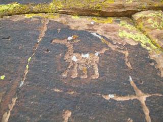
Along with that it has many undeveloped archaeological sites to discover as well. With rock art and ruins that can be found almost anywhere you go throughout the area. Here is some rock art found in the West clear Creek area. Another little known but great location to see some petroglyphs is Red Tank Draw http://azjonesoutdoor.blogspot.com/2011/07/red-tank-draw-petroglyph-site.html .
Here are some examples of the many Native American ruins that can be discovered that are undeveloped and not on the maps.
I have found so many of these types of sites that I have lost count of how many, and they are in every part of the valley. The Verde Valley also has miles and miles of designated scenic drives. This is a winter time view along the beautiful but rugged Schnebly Hill Road.
And along with all the great outdoor beauty the Verde Valley has some real nice weather, with very mild winters. The valley bottom is a little above 3000 feet in elevation and on the north is the edge of the Colorado Plateau, also known as the rim, on the south side is Mingus Mountain, The Black Hills, and the Verde Rim, These higher mountain and rim areas reach heights of between 7000 and 8000 feet in elevation. This drastic elevation change means the temperature will be much cooler at the higher elevation. So when it is hot down in the valley you can drive to the high locations and cool down in less than an hour. In winter we don't get much snow in the valley and it melts the next day if we do. But if you want some snow you can be sledding in 40 minutes by driving up to the mountain or rim areas.
Another great thing about where I live is it is a short drive to the Grand Canyon, Lake Powell, Southern Utah and the Arizona Rim areas northeast of Payson, making it the ideal base camp for exploring some of the Southwests best areas.
I drew this map of my little valley to give others an idea of how the place is situated, and I think it could be a cool resource to those visiting the area. Anyway I hope you can come and see it for yourself, you won't be disappointed.
Not sold yet? Check out "I Live In A Cool Place" Part One. http://azjonesoutdoor.blogspot.com/2011/02/i-live-in-cool-place.html
If you come to visit and fall in love with this area like I have, and decide to move here, when you buy a house be sure to have it checked out by Canyon Country Home Inspection http://www.canyoncountryhomeinspection.com/ To help you feel confident about your new home purchase.link directory


